Communities of the Central Coast
Here you will find information on Central Coast First Nations, Communities, and Community Projects and Initiatives.
Central Coast First Nations
The Central Coast encompasses land from four First Nations: Heiltsuk, Kitasoo/Xai'Xais, Nuxalk, and Wuikinuxv. The following summaries about these nations are taken from the Central Coast Indigenous Resource Alliance Communities page. More information can be found by following the links to each nation.
|
Heiltsuk Territory
"Heiltsuk Territory encompasses 16, 658 square kilometres of land as well as extensive nearshore and offshore waters. The territorial boundaries are defined by six Heiltsuk tribal groups and extend out into national waters. According to nuyem or oral tradition, the Heiltsuk have had a relationship with these rich and productive lands and waters for countless generations." |
Kitasoo/Xai’Xais Territory
"Kitasoo/Xai'Xais Territory is composed of both land and marine areas, totally 3939 square kilometres. The western portion of the territory is characterized by many windswept island groups and narrow channels. Deep valleys, long fjords and glaciated peaks of the Pacific Coast Range Mountains are typical of the eastern portion of the territory." |
|
Nuxalk Ancestral Territory
"Nuxalk Ancestral Territory includes 18,000 square kilometres of land as well as significant marine territory. Large watersheds draining several rivers and streams, deep valleys and fjords, and glaciated peaks of the Pacific Coast Range Mountains characterize the territory." |
Wuikinuxv Territory
"Wuikinuxv Territory is made up of both land and marine areas, with the land portion totalling almost 7,000 square kilometres and the marine portion totalling over 200 square kilometres. The territory is characterized by a significant lake network, temperate rain forests, deep valleys, and glaciated peaks of the Pacific Coast Range Mountains." |
Community Projects and Initiatives
|
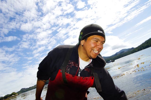
Coastal Guardian Watchmen Network This is part of the Coastal First Nations Great Bear Initiative of the North And Central Coast First Nations. The Coastal Guardian Watchmen work with fisheries, forestry, and parks to monitor the health of traditionally important marine and land resources on the coast, and to ensure that land and marine use plans are sustainable, successful, and properly implemented. They also monitor activities such as fishing, forestry, and tourism to ensure that rules and regulations are followed. Coastal Guardian Watchmen have a presence in all four of the above Central Coast First Nations. |
|
The Central Coast Indigenous Resource Alliance
The CCIRA is involved and and supports a number of First Nations projects, many to do with fisheries, resource use, and monitoring.
The Coastal First Nations Great Bear Initiative
This initiative has a number of campaigns and programs to do with economic improvement, environmental protection, and resource and land management. These include the Anti-Oil Tanker Campaign and the Canadians for the Great Bear Campaign, for which they have partnered with the World Wildlife Fund.
The Hakai Network for Coastal People, Ecosystems, and Management
Partnering with SFU and the Tula Foundation, the Hakai Network is a collaboration between researchers, students, First Nations communities, and community partners to undertake research projects that focus on sustainability and community well-being.
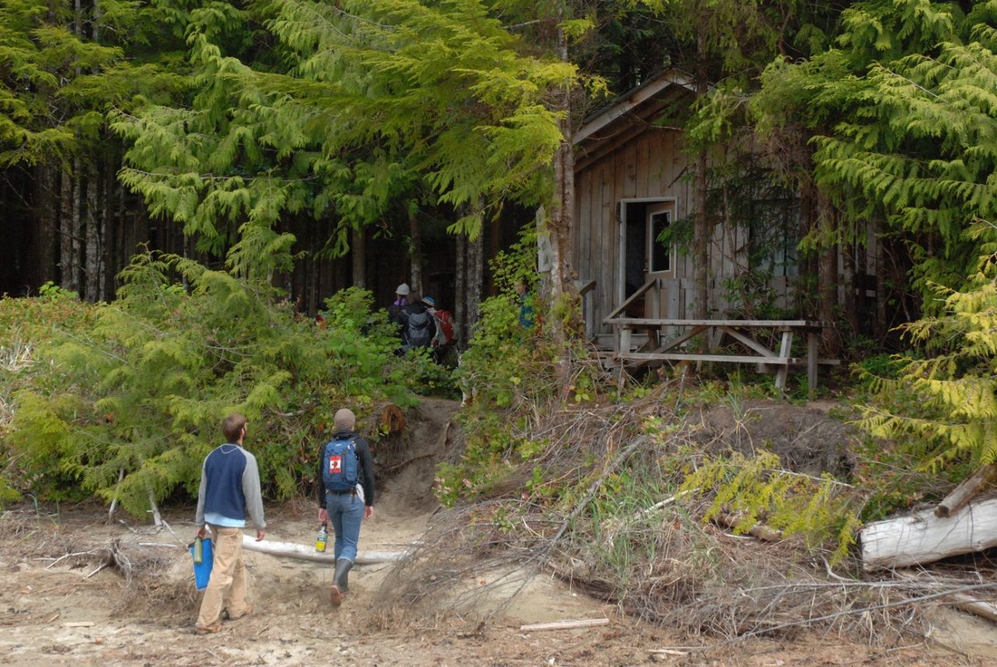
A Heiltsuk Cabins project cabin at the mouth of the Koeye River. Photo by Kelly Fretwell.
|
Qqs Projects Society
The motto of this Heiltsuk initiative, "supporting youth, culture, and environment," is evident in its many interconnected projects. Current projects include the cultural and scientific Koeye Camp for Heiltsuk youth, the scientific monitoring and stewardship program Coastwatch, and multiple scientific and culture projects on the Goose Islands. These are just a few of the society's projects - please see the website for more information, as well as the society's Facebook page and blog for updates. |
Koeye
The beautiful environment of the Koeye River Mouth has a small cluster of buildings that are home to some Heiltsuk community initiatives. The Koeye Camp is an annual summer science and cultural camp for Heiltsuk youth, and is part of the Qqs Projects Society. Two cabins from the Heiltsuk Cabins project are used by campers during the summer, as is the Koeye Bighouse (Dhadhixsistala). The Koeye Lodge was also used, but suffered damage in a Dec. 2011 fire (check the link or the Qqs blog for updates). As well, in 2012 a trail was built from the estuary to Little Koeye Lake, where a cabin was also built. The Hakai Institute blog entries on this project can be found here: April, June, August, and October.

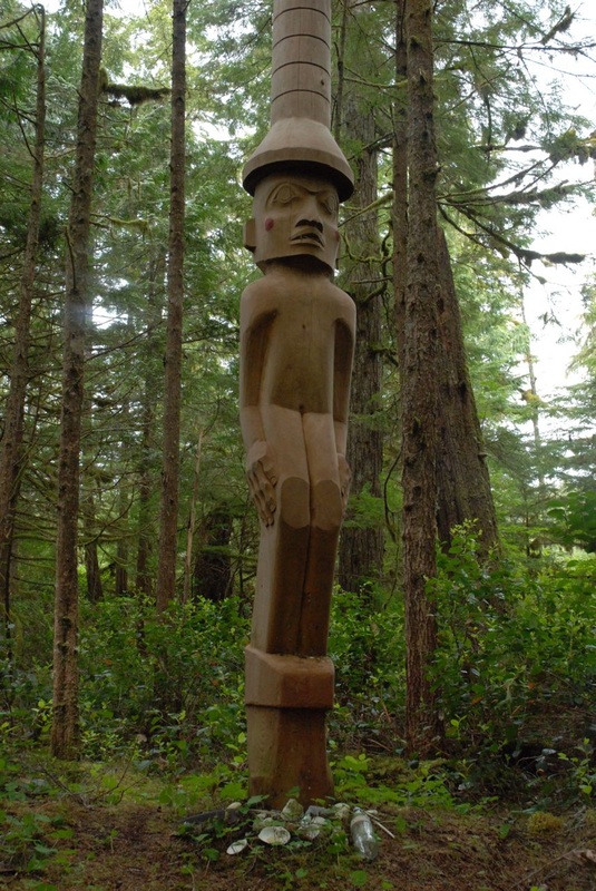
Koeye River, with a nearby totem. Photos by Kelly Fretwell.
|
|
There are also conservation and research projects ongoing at Koeye. Coastwatch has a Grizzly Bear Research Project (read a Nature Conservancy spotlight on this project and its director William Housty, or watch a short film showing the research in action.) As well, Qqs, the Heiltsuk Integrated Resource Management Department, the Hakai Institute, and other researchers are building a fish weir at Koeye for monitoring sockeye salmon returns. Read about it on the blogs of the following people/groups: Qqs, Hakai, and William Atlas.
Weir on the River Koeye video>>
The Koeye River Fish Weir Project - Qqs Projects Society video>>
Weir on the River Koeye video>>
The Koeye River Fish Weir Project - Qqs Projects Society video>>
The Koeye Conservancy surrounds the Koeye River, and covers Heiltsuk, Wuikinuxv, and Nuxalk territory. The Koeye Conservancy was purchased by the Nature Conservancy of Canada, with funding from the Tula Foundation. The Heiltsuk, Wuikinuxv, and Nuxalk Coastal Guardian Watchmen patrol the area around the Koeye Watershed.
More about the Koeye Watershed>>
More about the Koeye Watershed>>

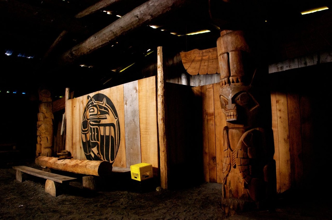
Koeye bighouse interior and exterior. Photos by Stuart Higgs.
|
|
|
Communities
Bella Bella (Waglisla) Bella Bella is a small community of about 1500 people, and is the home of the Heiltsuk First Nation. It is located on Campbell Island, and is one of the main transportation hubs along the Inside Passage. The Qqs Projects Society is based out of Bella Bella, and many of their projects are located in the town. The Koeye Cafe is a multi-purpose coffee shop, with a gift shop, gallery, visitor information, and the Qqs Projects Society office and headquarters. The cafe is attached to the Bella Bella Public Library (Thistalalh Memorial Library). A Bella Bella Bighouse is also in the works. The Bella Bella Community School uses both modern and traditional teaching methods with a focus on culture and environment. The school and Qqs partner with Pacific Wild in the SEAS Community Initiative. The Heiltsuk Coastal Guardian Watchmen program patrols the area around Bella Bella. More about Bella Bella>> |
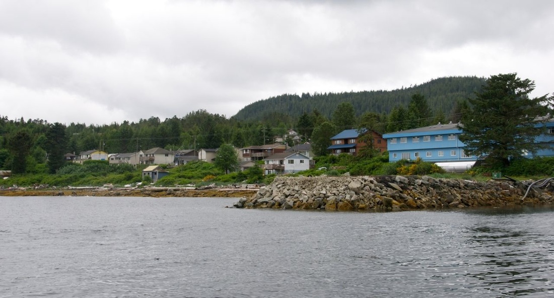
A glimpse of Bella Bella. Photo by Stuart Higgs.
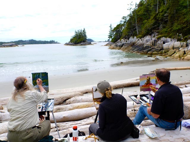
Artists from the Raincoast Conservation Foundation's Art for an Oil-Free Coast initiative paint on West Beach, Calvert Island. Photo by ES 470 participant.
|
Bella Coola Valley
The community of Bella Coola is lcoated on the mainland coast of BC, at the mouth of the Bella Coola River. It has a population of about 1900. The Bella Coola Valley is home to the Nuxalk First Nation. The Nuxalk school in Bella Bella is called Acwsalcta, and teaches provincial curricula as well as cultural and traditional courses. Community and cultural initiatives in the Bella Valley include the annual Bella Coola Music Festival, the Chako Kunamokst Rediscovery Camp which is part of the Nuxalk Nation Wellness Program, and the Bella Coola Community Support Society. The Nuxalk Nation has a Facebook page, which is regularly updated with community information. The Nuxalk Coastal Guardian Watchmen patrols the Bella Coola Valley.
More about communities in the Bella Coola Valley>>
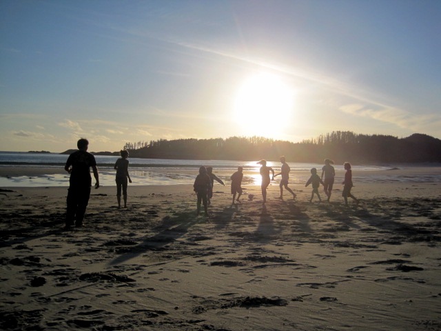
This game of beach soccer played on Calvert Island's West Beach was captured by Gillian Harvey.
|
Hakai Institute
While it is a research institute, Hakai tends to have a community-like atmosphere. It regularly hosts members of local communities as well visitors from elsewhere in the province. Many of the communities listed here have strong connections with Hakai. Community events include visits from nearby schoolchildren, teachers conferences, Coastal Guardian Watchmen conferences, and a visit in June 2012 from the Raincoast Conservation Foundation initiative Artists for an Oil-Free Coast. More about Hakai's community events>> |
Klemtu
Klemtu is a small community of about 400 people, located on Swindle Island. It is home to the Kitasoo/Xai'xais First Nation. It is also home base for the locally owned and operated Spirit Bear Lodge, which utilizes ecotourism of the Kitasoo/Xai'xais land to benefit the local economy and to promote conservation and research in the area. It is linked with the Klemtu-based Spirit Bear Research Foundation. The Kitasoo/Xai'xais Coastal Guardian Watchmen program patrols the area around Klemtu.
More about Klemtu>>
Namu
Namu was once a cannery town, but is now mostly a stopover site for travellers as well as a site of some historical significance. It has a rich archaeological history dating back 10,000 years. It has been the subject of study by the Department of Archaeology at Simon Fraser University in Burnaby, BC.
More about Namu's archaeological history>>
Ocean Falls
Ocean Falls is a small community on traditional Heiltsuk territory, located in Cousins Inlet on the mainland coast of BC. It has 35-60 residents year-round with around 150 during the summer. The Ocean Falls power company which operates out of the community serves Ocean Falls, Denny Island, and Bella Bella.
More about Ocean Falls>>
Oweekeno (Wuikinuxv or Rivers Inlet)
Oweekeno, also known as Rivers Inlet, is home to the Wuikinuxv First Nation. The village has around 70-90 residents. In 2005 the community built a big house, called House of Nuwakawa. This has resulted in increased community interest and involvement in traditional cultural practices, including traditional Wuikinuxv artwork. Oweekeno has a small school, which has two current development projects: an outdoor recreation court and a library. The Nature Conservancy of Canada and the Tula Foundation teamed up to save land in the Wannock River Estuary from being logged, and since then the Nature Conservancy and the Wuikinuxv Nation have worked together as stewards of that land. The area is now the subject of the Rivers Inlet Ecosystem Study, a project jointly worked on by SFU and UBC.
More about the Wuikinuxv Nation>>
More about Oweekeno >>
Shearwater on Denny Island
Shearwater is a small community close to Bella Bella, and is part of traditional Heiltsuk land. It has about 70 residents year-round, and is an ecotourism and recreational fishing destination. Community events can be found on the Denny Island Recreation Commission's Facebook page. Shearwater was used by the Royal Canadian Air Force in WWII.
More about Shearwater and Denny Island>>